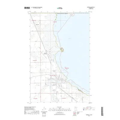
2019 Map of Warroad
USGS Topo · Published 2019About this map
The Warroad River flows into the expansive waters of Muskeg Bay along the southwestern shore of Lake of the Woods in this northern Minnesota survey. The settlement at Warroad serves as a focal point, showing a developed street grid including Lake St NE and Cemetary Rd, while the Warroad International Memorial Airport lies just to the west. Further north, the landscape transitions into more open terrain near the small settlement of Longworth, and the international boundary with the United States of America is marked near the northern reaches of Elm Point. Genealogists will find the locations of Riverside Cem and Saint Marys Cem documented south of the town center, providing precise locations for family history research. The map illustrates the varied transportation network of the late 2010s, ranging from county highways like Co Hwy 74 to local residential drives named for native trees, such as Birch Dr and Oak Rd.
Find a feature on this map
43 named features on this map. Tap any name to fly to it.
Don’t see what you’re looking for? This feature index may not catch every label — zoom into the map to look around manually.
Map Details
Editions of this 2019 Warroad Map
This is the sole edition of this map. No revisions or reprints were ever made.
Other maps of this area

1918 · Buffalo Bay
USGS Topo · 1:62,500

1918 · Roosevelt
USGS Topo · 1:62,500

1918 · Warroad
USGS Topo · 1:62,500

1943 · Roosevelt
USGS Topo · 1:62,500

1943 · Warroad
USGS Topo · 1:62,500

1954 · Roseau
USGS Topo · 1:250,000

1957 · Roseau
USGS Topo · 1:250,000

1958 · Roseau
USGS Topo · 1:250,000

1963 · Kenora
USGS Topo · 1:250,000

1967 · Roosevelt NW
USGS Topo · 1:24,000