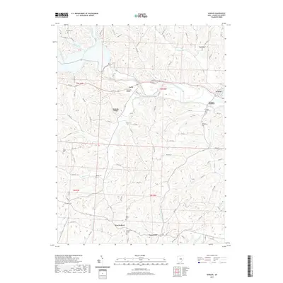
2019 Map of Warsaw
USGS Topo · Published 2019About this map
The Walhonding River carves a deep valley through this portion of Coshocton County, anchoring a landscape of ridge-top farms and riverside settlements. Along the northern bank, Nellie sits near the mouth of Opossum Hollow, while the larger village of Warsaw and the nearby Warsaw Junction occupy the eastern valley floor. The terrain is marked by a high density of rural burial grounds, including the Zion Evangelical Lutheran Cem and Mikesell Cem, which provide significant points of interest for genealogical research in the townships of T6N and T5N.
Find a feature on this map
93 named features on this map. Tap any name to fly to it.
Don’t see what you’re looking for? This feature index may not catch every label — zoom into the map to look around manually.
Map Details
Editions of this 2019 Warsaw Map
This is the sole edition of this map. No revisions or reprints were ever made.
Other maps of this area

1908 · Conesville
USGS Topo · 1:62,500

1910 · Frazeysburg
USGS Topo · 1:62,500

1910 · Conesville
USGS Topo · 1:62,500

1913 · Brinkhaven
USGS Topo · 1:62,500

1913 · Coshocton
USGS Topo · 1:62,500

1915 · Brinkhaven
USGS Topo · 1:62,500

1915 · Coshocton
USGS Topo · 1:62,500

1943 · Coshocton
USGS Topo · 1:62,500

1950 · Marion
USGS Topo · 1:250,000

1951 · Canton
USGS Topo · 1:250,000