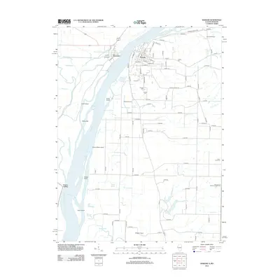
2012 Map of Warsaw
USGS Topo · Published 2012About this map
Warsaw sits prominently on the eastern bluff overlooking the Mississippi River, where the river's path is carved by a complex network of islands and sloughs. Across the water, the smaller settlement of Alexandria is situated near the confluence of the Fox River and the main channel. The landscape is defined by its riparian geometry, with named features like Hackley Island, Kamps-Stiens Island, and Taylor Island creating a fragmented waterway. The interior is a grid of agricultural land and drainage ways, such as Rocky Run and Shuhart Cr, which feed back toward the Mississippi.
Find a feature on this map
95 named features on this map. Tap any name to fly to it.
Don’t see what you’re looking for? This feature index may not catch every label — zoom into the map to look around manually.
Map Details
Editions of this 2012 Warsaw Map
This is the sole edition of this map. No revisions or reprints were ever made.
Other maps of this area

1903 · Kahoka
USGS Topo · 1:125,000

1936 · Keokuk
USGS Topo · 1:62,500

1946 · Mendon
USGS Topo · 1:62,500

1948 · Mendon
USGS Topo · 1:62,500

1949 · Wayland
USGS Topo · 1:24,000

1949 · Kahoka SE
USGS Topo · 1:24,000

1950 · Kahoka SE
USGS Topo · 1:24,000

1950 · Wayland
USGS Topo · 1:24,000

1950 · Keokuk
USGS Topo · 1:62,500

1950 · Canton
USGS Topo · 1:24,000