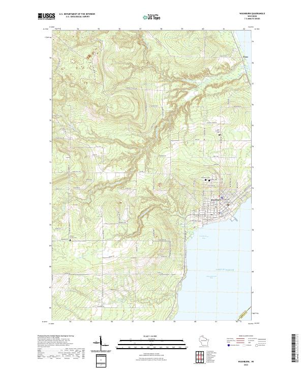
2022 Map of Washburn
USGS Topo · Published 2022About this map
Washburn sits prominently along the shoreline where Vandeventer Bay meets Chequamegon Bay on the southwestern edge of Lake Superior. As the seat of local government, the town is anchored by the Bayfield County Courthouse, with residential blocks stretching inland toward a series of community burial grounds including Woodlawn Cem, Calvary Cem, and Old Calvary Cem. The surrounding landscape is defined by the drainage systems of the Sioux River and Little Sioux River, which flow through a network of rural roads such as Friendly Valley Rd and N Niemisto Rd. Farther north, the small settlement of Sioux marks the transition toward the more wooded interior. The map reveals a contemporary rural-to-urban layout, where established township grids intersect with natural watercourses like Bono Cr and Thompson Cr.
Find a feature on this map
100 named features on this map. Tap any name to fly to it.
Don’t see what you’re looking for? This feature index may not catch every label — zoom into the map to look around manually.
Map Details
Editions of this 2022 Washburn Map
This is the sole edition of this map. No revisions or reprints were ever made.
Other maps of this area

1941 · Bayfield
USGS Topo · 1:48,000

1942 · Ashland
USGS Topo · 1:48,000

1944 · Moquah
USGS Topo · 1:48,000

1944 · Cornucopia
USGS Topo · 1:48,000

1946 · Cornucopia
USGS Topo · 1:48,000

1946 · Bayfield
USGS Topo · 1:48,000

1947 · Moquah
USGS Topo · 1:48,000

1947 · Ashland
USGS Topo · 1:48,000

1953 · Ashland
USGS Topo · 1:250,000

1958 · Ashland
USGS Topo · 1:250,000