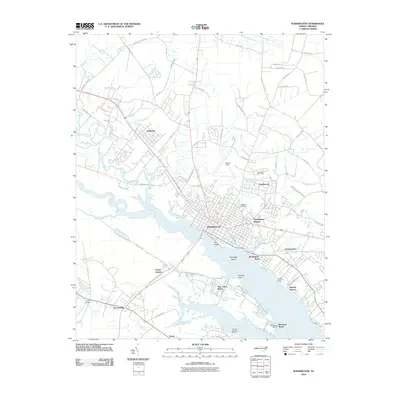
2010 Map of Washington
USGS Topo · Published 2010About this map
Washington and its surrounding riverfront communities sit at the critical confluence of the Tar River and the Pamlico River. This 2010 survey illustrates a landscape defined by its waterways, where established neighborhoods like Smallwood and Washington Park occupy the northern banks while Chocowinity serves as a southern anchor. The transition from the urban grid of the town center to the suburban and rural fringes is marked by several distinct residential developments, including Washington Heights and Rosedale, as well as recreational sites such as Twin Lakes Resort and the Pamlico Race Track.
Find a feature on this map
78 named features on this map. Tap any name to fly to it.
Don’t see what you’re looking for? This feature index may not catch every label — zoom into the map to look around manually.
Map Details
Editions of this 2010 Washington Map
This is the sole edition of this map. No revisions or reprints were ever made.
Other maps of this area

1902 · Vanceboro
USGS Topo · 1:62,500

1903 · Chocowinity
USGS Topo · 1:62,500

1904 · Vanceboro
USGS Topo · 1:62,500

1905 · Chocowinity
USGS Topo · 1:62,500

1905 · Vanceboro
USGS Topo · 1:62,500

1943 · Plymouth
USGS Topo · 1:125,000

1951 · Bunyan
USGS Topo · 1:24,000

1951 · Hackney
USGS Topo · 1:24,000

1951 · Washington
USGS Topo · 1:24,000

1953 · Blounts Bay
USGS Topo · 1:24,000