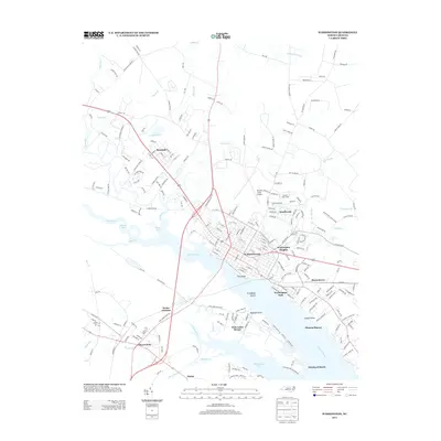
2013 Map of Washington
USGS Topo · Published 2013About this map
Washington serves as the focal point of this coastal plain landscape, situated where the Tar River meets the widening Pamlico River. The map details the city's residential expansion into neighborhoods like Smallwood and Washington Heights, while the waterfront remains defined by landmarks such as The Castle and the nearby Washington Park. This era of the city's development is characterized by a mix of established aviation infrastructure at Warren Field Airport and leisure spaces like the Pamlico Race Track.
Find a feature on this map
220 named features on this map. Tap any name to fly to it.
Don’t see what you’re looking for? This feature index may not catch every label — zoom into the map to look around manually.
Map Details
Editions of this 2013 Washington Map
This is the sole edition of this map. No revisions or reprints were ever made.
Other maps of this area

1902 · Vanceboro
USGS Topo · 1:62,500

1903 · Chocowinity
USGS Topo · 1:62,500

1904 · Vanceboro
USGS Topo · 1:62,500

1905 · Chocowinity
USGS Topo · 1:62,500

1905 · Vanceboro
USGS Topo · 1:62,500

1943 · Plymouth
USGS Topo · 1:125,000

1951 · Bunyan
USGS Topo · 1:24,000

1951 · Hackney
USGS Topo · 1:24,000

1951 · Washington
USGS Topo · 1:24,000

1953 · Blounts Bay
USGS Topo · 1:24,000