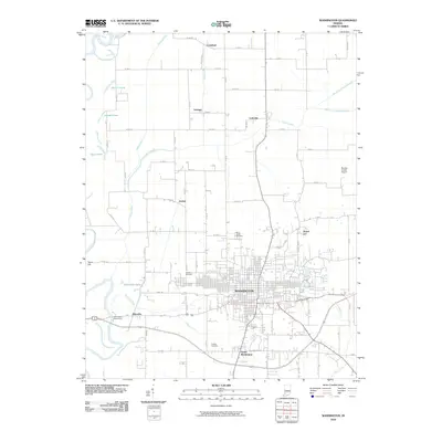
2010 Map of Washington
USGS Topo · Published 2010About this map
Washington and its surrounding agricultural landscape in Daviess County are defined by an intricate network of waterways and early 21st-century infrastructure. The White River winds along the western edge, joined by a system of drainage features including Prairie Creek, Hawes Ditch, and the Killion Canal. Smaller rural communities and historic place names like Jordan, Graham, and Lettsville are distributed across the northern township grids, while the southern edge of the city is marked by South Washington and the industrial footprint of the U.S. HWY. 50 BYP. Genealogists will find significant value in the documentation of local burial sites, including Saint Johns Cemetery, Hawkins Cemetery, and Colbert Cemetery. The presence of the Daviess County Airport and the Washington Waterworks near the river reflects the modern utility and transportation hubs serving the county seat during this era.
Find a feature on this map
54 named features on this map. Tap any name to fly to it.
Don’t see what you’re looking for? This feature index may not catch every label — zoom into the map to look around manually.
Map Details
Editions of this 2010 Washington Map
This is the sole edition of this map. No revisions or reprints were ever made.
Other maps of this area

1943 · Bicknell
USGS Topo · 1:24,000

1943 · Plainville
USGS Topo · 1:24,000

1943 · Epsom
USGS Topo · 1:24,000

1944 · Montgomery
USGS Topo · 1:24,000

1944 · Glendale
USGS Topo · 1:24,000

1944 · Washington
USGS Topo · 1:24,000

1944 · Monroe City
USGS Topo · 1:24,000

1944 · Wheatland
USGS Topo · 1:24,000

1945 · Sandy Hook
USGS Topo · 1:24,000

1956 · Vincennes
USGS Topo · 1:250,000