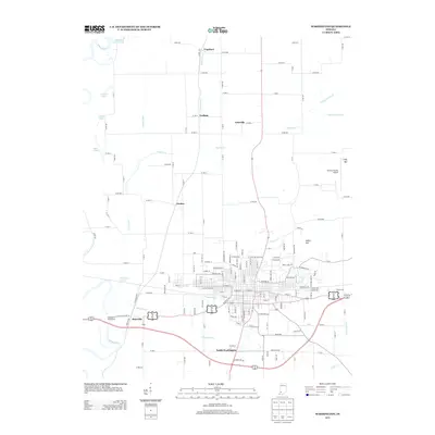
2013 Map of Washington
USGS Topo · Published 2013About this map
The White River winds through the western reaches of this Daviess County landscape, defining a floodplain marked by numerous water bodies like Melton Pond, Snyder Pond, and Blue Hole Pond. This 2013 survey illustrates the dense street grid of the county seat, anchored by thoroughfares such as State St and E Main St, while outlying residential clusters at South Washington and Maysville reflect the area's ongoing expansion. The intricate network of rural roads connects smaller historic points of interest, including Lettsville and Jordan, providing a clear view of the regional transition from urban center to agricultural land.
Find a feature on this map
67 named features on this map. Tap any name to fly to it.
Don’t see what you’re looking for? This feature index may not catch every label — zoom into the map to look around manually.
Map Details
Editions of this 2013 Washington Map
This is the sole edition of this map. No revisions or reprints were ever made.
Other maps of this area

1943 · Bicknell
USGS Topo · 1:24,000

1943 · Plainville
USGS Topo · 1:24,000

1943 · Epsom
USGS Topo · 1:24,000

1944 · Montgomery
USGS Topo · 1:24,000

1944 · Glendale
USGS Topo · 1:24,000

1944 · Washington
USGS Topo · 1:24,000

1944 · Monroe City
USGS Topo · 1:24,000

1944 · Wheatland
USGS Topo · 1:24,000

1945 · Sandy Hook
USGS Topo · 1:24,000

1956 · Vincennes
USGS Topo · 1:250,000