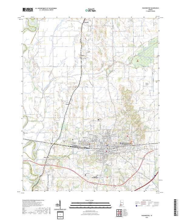
2022 Map of Washington
USGS Topo · Published 2022About this map
Washington serves as the central hub of this Daviess County landscape, where an intricate grid of urban streets meets the expansive agricultural reaches of southern Indiana. The city's eastern growth is marked by the Daviess County Airport, while the southern corridor transitions into South Washington. The map captures a complex drainage system essential to the local topography, featuring Hawkins Cr, Colbert Ditch, and Prairie Creek, all flowing west toward the White River valley along the western boundary. Significant genealogical sites are scattered throughout the rural sections, including Hawkins Cem and Oak Grove Cem near the small community of Jordan. The influence of logistics is evident in the CSX Transportation rail line that bisects the region, connecting the smaller settlements of Graham and Capehart to the primary industrial and commercial centers.
Find a feature on this map
70 named features on this map. Tap any name to fly to it.
Don’t see what you’re looking for? This feature index may not catch every label — zoom into the map to look around manually.
Map Details
Editions of this 2022 Washington Map
This is the sole edition of this map. No revisions or reprints were ever made.
Other maps of this area

1943 · Bicknell
USGS Topo · 1:24,000

1943 · Plainville
USGS Topo · 1:24,000

1943 · Epsom
USGS Topo · 1:24,000

1944 · Montgomery
USGS Topo · 1:24,000

1944 · Glendale
USGS Topo · 1:24,000

1944 · Washington
USGS Topo · 1:24,000

1944 · Monroe City
USGS Topo · 1:24,000

1944 · Wheatland
USGS Topo · 1:24,000

1945 · Sandy Hook
USGS Topo · 1:24,000

1956 · Vincennes
USGS Topo · 1:250,000