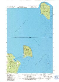
1982 Map of Washington Island NE
USGS Topo · Published 1994About this map
St Martin Island and Rock Island sit at the transition between Green Bay and Lake Michigan, marking the maritime gateway between Wisconsin and Michigan. The small settlement of Fairbanks on St. Martin Island contains a Cem and evidence of local industry at the Gravel Pit, while the northern tip of the island is marked by a Light. This survey reveals the preservation of the landscape through the Rock Island State Park and the Jackson Harbor Dunes Park on the northeastern tip of Washington Island. Historic navigation is anchored by the Pottawatomie Light, which stands watch over the Rock Island Passage. The map traces the rugged coastline from Southwest Bay to Jackson Harbor, providing a detailed look at the shoals and depths that defined early Great Lakes travel.
Find a feature on this map
26 named features on this map. Tap any name to fly to it.
Don’t see what you’re looking for? This feature index may not catch every label — zoom into the map to look around manually.
Map Details
Editions of this 1982 Washington Island NE Map
2 editions found
Other maps of this area

1932 · Burnt Bluff SW
USGS Topo · 1:31,680

1954 · Escanaba
USGS Topo · 1:250,000

1957 · Escanaba
USGS Topo · 1:250,000

1958 · Escanaba
USGS Topo · 1:250,000

1958 · Peninsula Point
USGS Topo · 1:62,500

1958 · Fairport
USGS Topo · 1:62,500

1960 · Washington Island
USGS Topo · 1:62,500

1982 · Washington Island SE
USGS Topo · 1:24,000

1982 · Washington Island NW
USGS Topo · 1:24,000

1982 · Washington Island NE
USGS Topo · 1:24,000