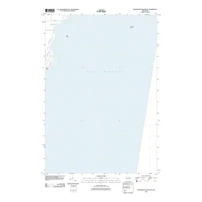
2010 Map of Washington Island SE
USGS Topo · Published 2010About this map
Lake Michigan dominates this coastal landscape on the southeastern edge of Washington Island in Door County. The map details a quiet maritime and wetland environment where the Big Marsh meets the lake's edge. A few local corridors, such as Michigan Rd and Lake View Rd, provide access to the shoreline and the tip of the island near South Point. Offshore, the survey identifies several hazards and landmarks critical for navigation, most notably the small landmass of Hog Island and the expansive Fisherman Shoal. This 2010 edition reflects the preserved natural state of these northeastern Wisconsin waters and the scattered coastal residential infrastructure along Shellswick Rd and Hemlock Dr.
Find a feature on this map
9 named features on this map. Tap any name to fly to it.
Don’t see what you’re looking for? This feature index may not catch every label — zoom into the map to look around manually.
Map Details
Editions of this 2010 Washington Island SE Map
This is the sole edition of this map. No revisions or reprints were ever made.
Other maps of this area

1954 · Escanaba
USGS Topo · 1:250,000

1957 · Escanaba
USGS Topo · 1:250,000

1958 · Escanaba
USGS Topo · 1:250,000

1960 · Washington Island
USGS Topo · 1:62,500

1982 · Washington Island SE
USGS Topo · 1:24,000

1982 · Washington Island NW
USGS Topo · 1:24,000

1982 · Washington Island NE
USGS Topo · 1:24,000
1982 · Washington Island SW
USGS Topo · 1:24,000
1982 · Spider Island
USGS Topo · 1:24,000

1984 · Washington Island
USGS Topo · 1:100,000