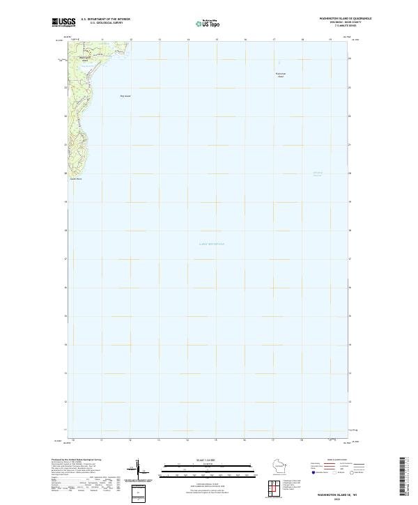
2022 Map of Washington Island SE
USGS Topo · Published 2022About this map
Washington Island anchors the northwestern corner of this coastal survey, where the terrestrial landscape meets the expansive waters of Lake Michigan. The interior geography is defined by significant wetland areas, specifically Little Marsh and Big Marsh, which illustrate the island's low-lying drainage patterns near the northern shore. A network of local corridors, including Michigan Rd, Deer Lane Rd, and Wickman Rd, provides access to these interior reaches and the northern coastline.
Find a feature on this map
17 named features on this map. Tap any name to fly to it.
Don’t see what you’re looking for? This feature index may not catch every label — zoom into the map to look around manually.
Map Details
Editions of this 2022 Washington Island SE Map
This is the sole edition of this map. No revisions or reprints were ever made.
Other maps of this area

1954 · Escanaba
USGS Topo · 1:250,000

1957 · Escanaba
USGS Topo · 1:250,000

1958 · Escanaba
USGS Topo · 1:250,000

1960 · Washington Island
USGS Topo · 1:62,500

1982 · Washington Island SE
USGS Topo · 1:24,000

1982 · Washington Island NW
USGS Topo · 1:24,000

1982 · Washington Island NE
USGS Topo · 1:24,000
1982 · Washington Island SW
USGS Topo · 1:24,000
1982 · Spider Island
USGS Topo · 1:24,000

1984 · Washington Island
USGS Topo · 1:100,000