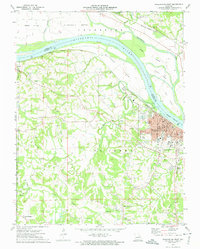
1973 Map of Washington West
USGS Topo · Published 1974About this map
The Missouri River forms the central geographic axis of this region, separating the bottomlands of La Charrette Bottom in Warren County from the expanding industrial and residential core of Washington in Franklin County. In the early 1970s, the area reflects a transition from river-based agriculture to a more complex local economy, evidenced by numerous quarries and the dense rail corridor of the Missouri Pacific and Missouri - Kansas - Texas lines.
Find a feature on this map
61 named features on this map. Tap any name to fly to it.
Don’t see what you’re looking for? This feature index may not catch every label — zoom into the map to look around manually.
Map Details
Editions of this 1973 Washington West Map
2 editions found
Other maps of this area

1890 · Hermann
USGS Topo · 1:125,000

1901 · De Soto
USGS Topo · 1:125,000

1903 · O'Fallon
USGS Topo · 1:125,000

1903 · Sullivan
USGS Topo · 1:125,000

1946 · Union
USGS Topo · 1:62,500

1947 · St. Clair
USGS Topo · 1:62,500

1948 · Union
USGS Topo · 1:62,500

1948 · Washington
USGS Topo · 1:62,500

1948 · Augusta
USGS Topo · 1:62,500

1949 · Saint Louis
USGS Topo · 1:250,000