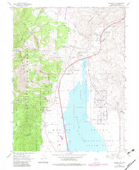
1968 Map of Washoe City
USGS Topo · Published 1983About this map
Washoe Valley and the eastern slopes of the Carson National Forest dominate this landscape, capturing a period of transition as historical mining and ranching settlements evolved into residential communities. The map depicts the long-standing community of Washoe City near Washoe Hill, contrasted with the emerging suburban grid of New Washoe City along East Lake Boulevard. This development pattern is hemmed in by the sprawling Washoe Lake and the Scripps State Wildlife Management Area, which protect the wetlands at the valley floor.
Find a feature on this map
55 named features on this map. Tap any name to fly to it.
Don’t see what you’re looking for? This feature index may not catch every label — zoom into the map to look around manually.
Map Details
Editions of this 1968 Washoe City Map
4 editions found
Other maps of this area

1891 · Carson
USGS Topo · 1:125,000

1893 · Carson
USGS Topo · 1:125,000

1950 · Virginia City
USGS Topo · 1:62,500

1950 · Mt. Rose
USGS Topo · 1:62,500

1952 · Mt. Rose
USGS Topo · 1:62,500

1952 · Virginia City
USGS Topo · 1:62,500

1955 · Marlette Lake
USGS Topo · 1:24,000

1956 · Dayton
USGS Topo · 1:62,500

1956 · Carson City
USGS Topo · 1:62,500

1957 · Reno
USGS Topo · 1:250,000