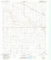
1965 Map of Wasson
USGS Topo · Published 1991About this map
Running Water Draw meanders across this High Plains landscape, defining the topography of Hale County during the mid-1960s. The map illustrates a specialized agricultural economy centered on cotton production, evidenced by the presence of the West Side Cotton Gin and the Heck Cotton Gin. Small railway-adjacent or road-junction settlements like Boone, Wasson, and Furguson serve as anchors for the surrounding rural territory. Industrial infrastructure is prominent near the rail lines, including a Chemical Plant and several Storage Bins. The map also captures modern utility developments in the form of a major Aqueduct and Pipeline crossing the plains, alongside traditional features such as a Gravel Pit and various water tanks. This survey provides a clear look at the transition from early ranching eras to a more mechanized, industrial-scale farming period.
Find a feature on this map
13 named features on this map. Tap any name to fly to it.
Don’t see what you’re looking for? This feature index may not catch every label — zoom into the map to look around manually.
Map Details
Editions of this 1965 Wasson Map
2 editions found
Other maps of this area

1954 · Plainview
USGS Topo · 1:250,000

1958 · Plainview
USGS Topo · 1:250,000

1965 · Kress West
USGS Topo · 1:24,000

1965 · Edmonson
USGS Topo · 1:24,000

1965 · Wasson
USGS Topo · 1:24,000

1965 · Plainview
USGS Topo · 1:24,000

1968 · Halfway
USGS Topo · 1:24,000

1968 · Happy Union
USGS Topo · 1:24,000
1968 · Hale Center SW
USGS Topo · 1:24,000
1968 · Hale Center
USGS Topo · 1:24,000