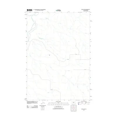
2012 Map of Wasta NE
USGS Topo · Published 2012About this map
The Cheyenne River carves through the northwestern corner of this territory, where it meets the drainage of Elk Cr. This landscape is defined by its wide, open drainages and the broad plateau of Cow Flat. A network of intermittent streams, including Cow Cr, Calf Cr, and Bull Cr, create a complex dendritic pattern across the plains, illustrating the natural water management of the western South Dakota rangeland.
Find a feature on this map
9 named features on this map. Tap any name to fly to it.
Don’t see what you’re looking for? This feature index may not catch every label — zoom into the map to look around manually.
Map Details
Editions of this 2012 Wasta NE Map
This is the sole edition of this map. No revisions or reprints were ever made.
Other maps of this area

1953 · Rapid City
USGS Topo · 1:250,000

1954 · Dalzell SE
USGS Topo · 1:24,000

1954 · Wasta NE
USGS Topo · 1:24,000

1954 · Wasta SE
USGS Topo · 1:24,000

1954 · Dalzell
USGS Topo · 1:24,000

1954 · Wasta
USGS Topo · 1:24,000

1954 · Wasta NW
USGS Topo · 1:24,000

1955 · Creighton
USGS Topo · 1:24,000

1957 · Rapid City
USGS Topo · 1:250,000
1983 · Lake Hill
USGS Topo · 1:24,000