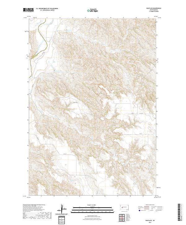
2021 Map of Wasta NE
USGS Topo · Published 2021About this map
The Cheyenne River carves a significant path through this section of the western South Dakota plains, defining the boundary between Pennington and Meade counties. The landscape is marked by a complex system of drainage draws and seasonal creeks, including Elk Cr, Cow Cr, and Calf Cr, which feed into the main river channel. High plateaus and level grazing areas like Cow Flat break up the dissected terrain, while named features such as Seventy-six Draw suggest a ranching history tied to the early livestock brands and pioneer routes of the region. Transportation in this area relies on a sparse network of section-line roads and named thoroughfares like Trask Rd and Pascoe Rd, reflecting the low-density settlement patterns typical of the state's river-basin country during the early twenty-first century.
Find a feature on this map
17 named features on this map. Tap any name to fly to it.
Don’t see what you’re looking for? This feature index may not catch every label — zoom into the map to look around manually.
Map Details
Editions of this 2021 Wasta NE Map
This is the sole edition of this map. No revisions or reprints were ever made.
Other maps of this area

1953 · Rapid City
USGS Topo · 1:250,000

1954 · Dalzell SE
USGS Topo · 1:24,000

1954 · Wasta NE
USGS Topo · 1:24,000

1954 · Wasta SE
USGS Topo · 1:24,000

1954 · Dalzell
USGS Topo · 1:24,000

1954 · Wasta
USGS Topo · 1:24,000

1954 · Wasta NW
USGS Topo · 1:24,000

1955 · Creighton
USGS Topo · 1:24,000

1957 · Rapid City
USGS Topo · 1:250,000
1983 · Lake Hill
USGS Topo · 1:24,000