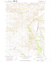
1954 Map of Wasta NW
USGS Topo · Published 1979About this map
The Cheyenne River winds through the heart of this mid-century Western South Dakota landscape, carving a deep valley that separates the high plateau from the river plains. Along its banks, the Levee near Bull Cr indicates early efforts to manage the river's seasonal volatility. The terrain is defined by dramatic erosional features like Telegraph Draw and Fivemile Draw, which drain the arid uplands toward the river valley.
Find a feature on this map
13 named features on this map. Tap any name to fly to it.
Don’t see what you’re looking for? This feature index may not catch every label — zoom into the map to look around manually.
Map Details
Editions of this 1954 Wasta NW Map
2 editions found
Other maps of this area

1953 · Rapid City
USGS Topo · 1:250,000

1954 · Dalzell SE
USGS Topo · 1:24,000

1954 · Wasta NE
USGS Topo · 1:24,000

1954 · Wasta SE
USGS Topo · 1:24,000

1954 · Dalzell
USGS Topo · 1:24,000

1954 · Wasta
USGS Topo · 1:24,000

1954 · Owanka
USGS Topo · 1:24,000

1954 · Wasta NW
USGS Topo · 1:24,000

1954 · Elm Springs
USGS Topo · 1:24,000

1957 · Rapid City
USGS Topo · 1:250,000