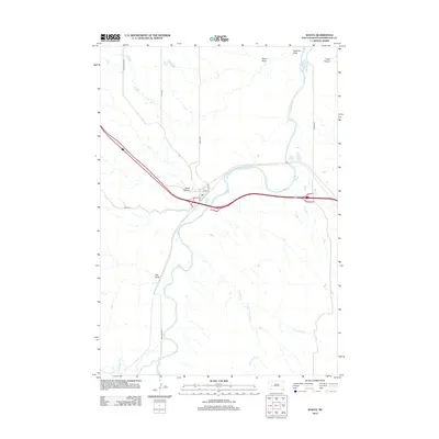
2012 Map of Wasta
USGS Topo · Published 2012About this map
The Cheyenne River snakes through this Pennington County landscape, defining the topography south of the Wasta townsite. The settlement of Wasta is concentrated along Elm St, Pine St, and C Ave, positioned where the high plains break into the river valley. This 2012 survey illustrates a landscape of complex drainage patterns, where significant dry-land features like Fivemile Draw, Sand Draw, and Pats Draw feed into the larger river system. North of the town, Shyne Lake provides a distinct water feature on the plateau. To the east, the terrain becomes increasingly dissected by Cedar Canyon and Hawk Canyon, showcasing the erosional forces typical of this region of South Dakota. Local transit is managed via a network of rural routes including Elm Springs Rd, Jensen Rd, and Base Line Rd, which serve the outlying ranching and agricultural lands.
Find a feature on this map
21 named features on this map. Tap any name to fly to it.
Don’t see what you’re looking for? This feature index may not catch every label — zoom into the map to look around manually.
Map Details
Editions of this 2012 Wasta Map
This is the sole edition of this map. No revisions or reprints were ever made.
Other maps of this area

1953 · Rapid City
USGS Topo · 1:250,000

1954 · Wasta NE
USGS Topo · 1:24,000

1954 · Wasta SE
USGS Topo · 1:24,000

1954 · Wasta
USGS Topo · 1:24,000

1954 · Owanka
USGS Topo · 1:24,000

1954 · Wasta NW
USGS Topo · 1:24,000

1954 · Brennan Flat
USGS Topo · 1:24,000

1954 · Quinn Table
USGS Topo · 1:24,000

1955 · Hot Springs
USGS Topo · 1:250,000

1957 · Rapid City
USGS Topo · 1:250,000