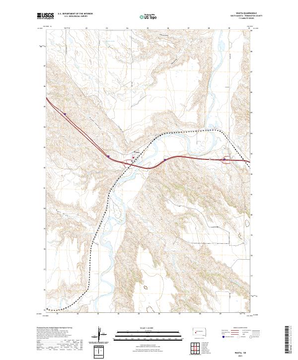
2021 Map of Wasta
USGS Topo · Published 2021About this map
The town of Wasta occupies a central position in this Pennington County landscape, situated along the broad valley of the Cheyenne River. The 2021 topography reveals a rugged drainage network defined by numerous seasonal waterways and erosion features. To the north, Shyne Lake and the Sand Draw catchment characterize the high ground, while the southern reaches are shaped by the meandering paths of Crooked Cr and the S Fork Crooked Cr. Transport routes like HWY 1416 and Elm Springs RD follow the natural contours of the land, avoiding the steep descents into Hawk Canyon and Pats Draw. The map illustrates how local development has adapted to the winding river corridor and the complex creek systems, including Boxelder Cr and Bull Cr, which define the ranching and agricultural potential of this western South Dakota region.
Find a feature on this map
21 named features on this map. Tap any name to fly to it.
Don’t see what you’re looking for? This feature index may not catch every label — zoom into the map to look around manually.
Map Details
Editions of this 2021 Wasta Map
This is the sole edition of this map. No revisions or reprints were ever made.
Other maps of this area

1953 · Rapid City
USGS Topo · 1:250,000

1954 · Wasta NE
USGS Topo · 1:24,000

1954 · Wasta SE
USGS Topo · 1:24,000

1954 · Wasta
USGS Topo · 1:24,000

1954 · Owanka
USGS Topo · 1:24,000

1954 · Wasta NW
USGS Topo · 1:24,000

1954 · Brennan Flat
USGS Topo · 1:24,000

1954 · Quinn Table
USGS Topo · 1:24,000

1955 · Hot Springs
USGS Topo · 1:250,000

1957 · Rapid City
USGS Topo · 1:250,000