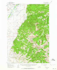
1960 Map of Waterloo
USGS Topo · Published 1972About this map
The Jefferson River defines the western valley floor of this Montana landscape, where the Northern Pacific railroad tracks parallel the water near the settlement of Waterloo. This 1960 survey illustrates a sharp transition from the irrigated ranch lands of The Bench and the Parrot Ditch to the high alpine reaches of the Deerlodge National Forest. Genealogists and historians can trace several named properties including Riverside Ranch, Wagon Wheel Ranch, and White Rock Ranch, which highlight the importance of river-bottom agriculture during this era.
Find a feature on this map
116 named features on this map. Tap any name to fly to it.
Don’t see what you’re looking for? This feature index may not catch every label — zoom into the map to look around manually.
Map Details
Editions of this 1960 Waterloo Map
2 editions found

Other maps of this area

1888 · Three Forks
USGS Topo · 1:250,000

1893 · Dillon
USGS Topo · 1:250,000

1894 · Three Forks
USGS Topo · 1:250,000

1895 · Three Forks
USGS Topo · 1:250,000

1947 · Bozeman
USGS Topo · 1:250,000

1948 · Bozeman
USGS Topo · 1:250,000

1950 · Jefferson Island
USGS Topo · 1:62,500

1950 · Harrison
USGS Topo · 1:62,500

1950 · Virginia City
USGS Topo · 1:62,500

1955 · Bozeman
USGS Topo · 1:250,000