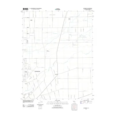
2012 Map of Waterloo
USGS Topo · Published 2012About this map
The Calaveras River and Pixley Slough define the drainage of this fertile Central Valley landscape, which is marked by a transition from the agricultural eastern outskirts of Stockton to the vineyard-heavy lands near Lodi. The map details the rural-to-suburban interface of Morada and Waterloo, where established orchard grids meet growing residential streets. To the north, specialized local aviation and viticulture intersect at the Faber Vineyards Airport, while smaller settlements like Kettleman, Ampere, and Haight trace the historical development along the north-south road corridors. This 2012 survey captures a moment when the San Joaquin County interior remained deeply tied to its watercourses, featuring complex irrigation and drainage networks including Paddy Creek, Middle Paddy Creek, and South Paddy Creek.
Find a feature on this map
113 named features on this map. Tap any name to fly to it.
Don’t see what you’re looking for? This feature index may not catch every label — zoom into the map to look around manually.
Map Details
Editions of this 2012 Waterloo Map
This is the sole edition of this map. No revisions or reprints were ever made.
Other maps of this area

1894 · Lodi
USGS Topo · 1:125,000

1908 · Waterloo
USGS Topo · 1:31,680

1908 · Linden
USGS Topo · 1:31,680

1908 · Lockeford
USGS Topo · 1:31,680

1909 · Clements
USGS Topo · 1:31,680

1910 · Castle
USGS Topo · 1:31,680

1910 · Woodbridge
USGS Topo · 1:31,680

1913 · Stockton
USGS Topo · 1:31,680

1914 · Burnham
USGS Topo · 1:31,680

1915 · Peters
USGS Topo · 1:31,680