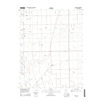
2015 Map of Waterloo
USGS Topo · Published 2015About this map
The Calaveras River and several sloughs cross this San Joaquin Valley landscape, defining the agricultural and water infrastructure east of Lodi. Small rural settlements and named junctions such as Waterloo, Morada, and Foppiano anchor the local road network, which follows a rigid section-line grid. Significant hydrological features include the Mokelumne Aqueduct, which cuts diagonally across the township lines, and the natural drainage of Pixley Slough and Bear Creek. The map documents a blend of intensive farming and small aviation at Wallom Field, alongside established rail-adjacent points like Kettleman and Ampere. This area represents the heart of the region's produce-shipping history, where local roads like E Eight Mile Rd and N Jack Tone Rd connect family-named corners such as Haight and Hawes to the broader valley markets.
Find a feature on this map
98 named features on this map. Tap any name to fly to it.
Don’t see what you’re looking for? This feature index may not catch every label — zoom into the map to look around manually.
Map Details
Editions of this 2015 Waterloo Map
This is the sole edition of this map. No revisions or reprints were ever made.
Other maps of this area

1894 · Lodi
USGS Topo · 1:125,000

1908 · Waterloo
USGS Topo · 1:31,680

1908 · Linden
USGS Topo · 1:31,680

1908 · Lockeford
USGS Topo · 1:31,680

1909 · Clements
USGS Topo · 1:31,680

1910 · Castle
USGS Topo · 1:31,680

1910 · Woodbridge
USGS Topo · 1:31,680

1913 · Stockton
USGS Topo · 1:31,680

1914 · Burnham
USGS Topo · 1:31,680

1915 · Peters
USGS Topo · 1:31,680