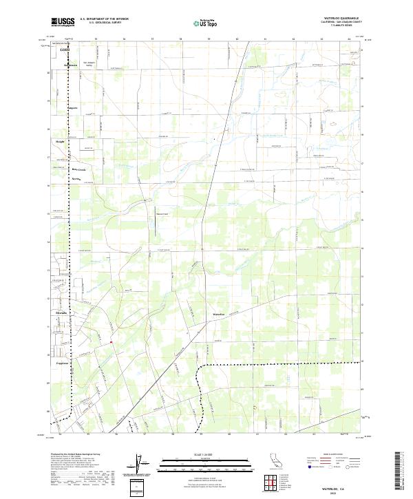
2022 Map of Waterloo
USGS Topo · Published 2022About this map
The San Joaquin Valley east of Lodi is characterized by a dense grid of agricultural roads and irrigation waterways, defining this productive landscape in the early 21st century. The central settlement of Waterloo serves as a focal point, surrounded by established community clusters like Morada, Norton, and Foppiano. Water management is the primary architectural force of the terrain, evidenced by the prominent Mokelumne Aqueduct slicing through the valley and the meandering paths of the Calaveras River and Pixley Slough. This network of sloughs and creeks, including Bear Creek and several branches of Paddy Creek, illustrates the complex drainage required to maintain the region's agricultural vitality. Beyond the towns, named locations such as Ampere and Haight indicate localized hubs along the section-line roads, while Wallom Field provides a distinct landmark within the expansive rural layout.
Find a feature on this map
102 named features on this map. Tap any name to fly to it.
Don’t see what you’re looking for? This feature index may not catch every label — zoom into the map to look around manually.
Map Details
Editions of this 2022 Waterloo Map
This is the sole edition of this map. No revisions or reprints were ever made.
Other maps of this area

1894 · Lodi
USGS Topo · 1:125,000

1908 · Waterloo
USGS Topo · 1:31,680

1908 · Linden
USGS Topo · 1:31,680

1908 · Lockeford
USGS Topo · 1:31,680

1909 · Clements
USGS Topo · 1:31,680

1910 · Castle
USGS Topo · 1:31,680

1910 · Woodbridge
USGS Topo · 1:31,680

1913 · Stockton
USGS Topo · 1:31,680

1914 · Burnham
USGS Topo · 1:31,680

1915 · Peters
USGS Topo · 1:31,680