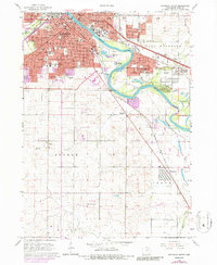
1963 Map of Waterloo South
USGS Topo · Published 1986About this map
The Cedar River carves a path through the heart of this urban and agricultural transition, separating the sprawling city of Waterloo from its neighbors Evansdale and Elk Run Heights. The 1963 survey shows the post-war expansion of the city, with a dense network of residential streets and numerous educational and religious institutions, such as Sacred Heart Sch and Columbus High Sch. To the south, the landscape shifts toward the townships of Orange and Cedar, where the smaller settlement of Washburn sits along the Chicago Rock Island and Pacific tracks.
Find a feature on this map
58 named features on this map. Tap any name to fly to it.
Don’t see what you’re looking for? This feature index may not catch every label — zoom into the map to look around manually.
Map Details
Editions of this 1963 Waterloo South Map
3 editions found
Other maps of this area

1954 · Waterloo
USGS Topo · 1:250,000

1955 · Waterloo
USGS Topo · 1:250,000

1963 · Buckingham
USGS Topo · 1:24,000

1963 · Hudson
USGS Topo · 1:24,000

1963 · Waterloo South
USGS Topo · 1:24,000

1963 · Eagle Center
USGS Topo · 1:24,000

1963 · Cedar Falls
USGS Topo · 1:24,000

1963 · Waterloo North
USGS Topo · 1:24,000

1971 · Gilbertville
USGS Topo · 1:24,000

1971 · La Porte City
USGS Topo · 1:24,000