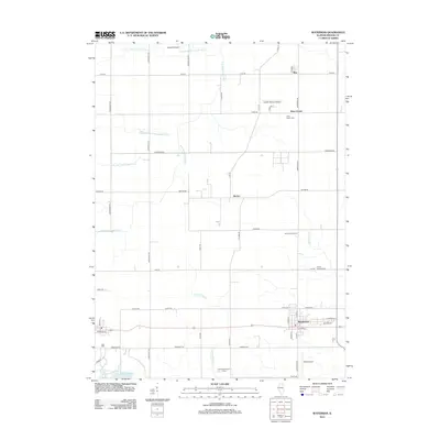
2012 Map of Waterman
USGS Topo · Published 2012About this map
Waterman anchors this rural DeKalb County landscape, where the flat agricultural terrain is defined by a dense grid of local roads and the winding paths of the S Br Kishwaukee River and its various branches. Small agrarian centers like McGirr, Elva, and Afton Center punctuate the landscape, preserving the quiet character of north-central Illinois. Genealogists can identify key burial sites such as Afton Center Cem and North Clinton Cem, while the inclusion of local operations like the Honey Hill Orchard and Kauffman Poultry Farm highlights the area's continued reliance on the land.
Find a feature on this map
51 named features on this map. Tap any name to fly to it.
Don’t see what you’re looking for? This feature index may not catch every label — zoom into the map to look around manually.
Map Details
Editions of this 2012 Waterman Map
This is the sole edition of this map. No revisions or reprints were ever made.
Other maps of this area

1934 · De Kalb
USGS Topo · 1:62,500

1937 · De Kalb
USGS Topo · 1:62,500

1937 · Sycamore
USGS Topo · 1:62,500

1948 · Sandwich
USGS Topo · 1:62,500

1950 · Sandwich
USGS Topo · 1:62,500

1951 · Earlville
USGS Topo · 1:62,500

1958 · Aurora
USGS Topo · 1:250,000

1961 · Aurora
USGS Topo · 1:250,000
1968 · Sycamore
USGS Topo · 1:24,000
1968 · Hinckley
USGS Topo · 1:24,000