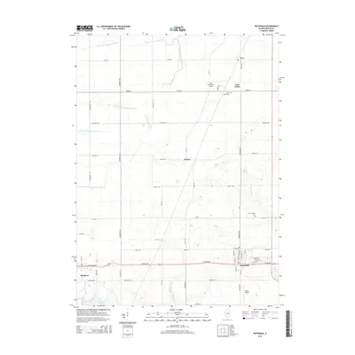
2015 Map of Waterman
USGS Topo · Published 2015About this map
The agricultural landscape of Clinton Township and surrounding DeKalb County is defined by a dense grid of rural roads and the complex branching of the Kishwaukee River system. In the southern portion of the map, the village of Waterman serves as a local hub at the junction of W Lincoln St and Waterman Rd, while the western edge reaches Shabbona near the shores of Shabbona Lake.
Find a feature on this map
42 named features on this map. Tap any name to fly to it.
Don’t see what you’re looking for? This feature index may not catch every label — zoom into the map to look around manually.
Map Details
Editions of this 2015 Waterman Map
This is the sole edition of this map. No revisions or reprints were ever made.
Other maps of this area

1934 · De Kalb
USGS Topo · 1:62,500

1937 · De Kalb
USGS Topo · 1:62,500

1937 · Sycamore
USGS Topo · 1:62,500

1948 · Sandwich
USGS Topo · 1:62,500

1950 · Sandwich
USGS Topo · 1:62,500

1951 · Earlville
USGS Topo · 1:62,500

1958 · Aurora
USGS Topo · 1:250,000

1961 · Aurora
USGS Topo · 1:250,000
1968 · Sycamore
USGS Topo · 1:24,000
1968 · Hinckley
USGS Topo · 1:24,000