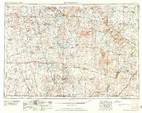
1958 Map of Watertown
USGS Topo · Published 1958About this map
Watertown and its surrounding prairie lakes anchor this mid-century survey of eastern South Dakota and western Minnesota. The landscape is defined by the glacial geography of the South Coteau and East Coteau, characterized by hundreds of water bodies including Lake Kampeska, Lake Poinsett, and Lake Benton. This era shows the region as a critical rail-and-agriculture hub, where the tracks of the Great Northern and the Chicago and North Western connect dispersed farming communities like Arlington, De Smet, and Canby. A portion of the Sisseton Indian Reservation is visible to the north, while the southern reaches include the pipestone quarries near Pipestone. The map preserves the infrastructure of the 1950s, from early township grids to small settlements like Castlewood and Estelline before the expansion of the modern interstate system.
Find a feature on this map
173 named features on this map. Tap any name to fly to it.
Don’t see what you’re looking for? This feature index may not catch every label — zoom into the map to look around manually.
Map Details
Editions of this 1958 Watertown Map
2 editions found

Other maps of this area

1894 · Conde
USGS Topo · 1:62,500

1895 · Byron
USGS Topo · 1:125,000

1895 · Aberdeen
USGS Topo · 1:125,000

1898 · Huron
USGS Topo · 1:125,000

1899 · Mitchell
USGS Topo · 1:125,000

1899 · Alexandria
USGS Topo · 1:125,000

1899 · De Smet
USGS Topo · 1:125,000

1953 · Bellingham
USGS Topo · 1:62,500

1953 · Milbank
USGS Topo · 1:250,000

1953 · Huron
USGS Topo · 1:250,000