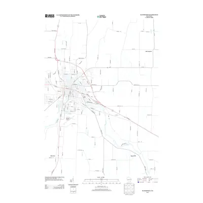
2013 Map of Watertown
USGS Topo · Published 2013About this map
The Rock River winds through the heart of this Wisconsin landscape, defining the character of the settlement at Watertown and its surrounding rural townships. This 2013 survey records the intricate network of island and water features near the city center, most notably Tivoli Island and the neighboring Heiden Pond and Lake Victoria. The geographic layout reflects a transition from the dense street grids of the urban core to the expansive dairy and farmland of the Dodge and Jefferson County borderlands.
Find a feature on this map
125 named features on this map. Tap any name to fly to it.
Don’t see what you’re looking for? This feature index may not catch every label — zoom into the map to look around manually.
Map Details
Editions of this 2013 Watertown Map
This is the sole edition of this map. No revisions or reprints were ever made.
Other maps of this area

1891 · Waterloo
USGS Topo · 1:62,500

1892 · Watertown
USGS Topo · 1:62,500

1894 · Waterloo
USGS Topo · 1:62,500

1894 · Watertown
USGS Topo · 1:62,500

1910 · Waterloo
USGS Topo · 1:62,500

1955 · Beaver Dam
USGS Topo · 1:62,500

1955 · Horicon
USGS Topo · 1:62,500

1957 · Madison
USGS Topo · 1:250,000
1959 · Richwood
USGS Topo · 1:24,000
1959 · Helenville
USGS Topo · 1:24,000