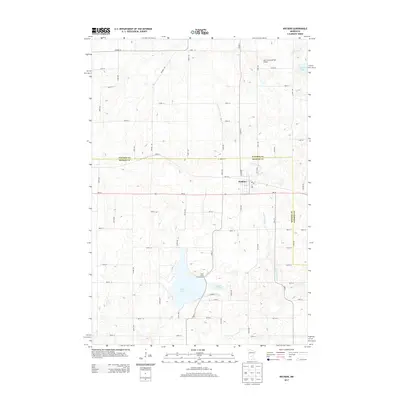
2013 Map of Watkins
USGS Topo · Published 2013About this map
Watkins serves as the primary hub of this landscape, situated along the MN-55 corridor at the transition between Meeker and Stearns counties. The town's grid is anchored by the Po and 1st St, showing the concentrated residential and commercial core as it appeared in the early 21st century. The surrounding terrain is defined by a glacial aquatic system, most notably Clear Lake and its associated Clear Creek Campground. These water features, alongside Little Mud Lake and Island Lake, indicate a region where the natural environment and recreation are closely integrated into the local economy. The mapping of Don's Landing Field Airport to the northeast highlights the rural aviation infrastructure that serves these prairie communities. Navigated by a dense network of township roads like Co Hwy-2 and 160th St, the area maintains a distinct agricultural and lakeside character.
Find a feature on this map
35 named features on this map. Tap any name to fly to it.
Don’t see what you’re looking for? This feature index may not catch every label — zoom into the map to look around manually.
Map Details
Editions of this 2013 Watkins Map
This is the sole edition of this map. No revisions or reprints were ever made.
Other maps of this area

1953 · Saint Cloud
USGS Topo · 1:250,000

1957 · Saint Cloud
USGS Topo · 1:250,000

1958 · Saint Cloud
USGS Topo · 1:250,000

1958 · Dassel
USGS Topo · 1:62,500

1967 · Cold Spring
USGS Topo · 1:24,000

1967 · Litchfield North
USGS Topo · 1:24,000

1967 · Richmond
USGS Topo · 1:24,000

1967 · Watkins
USGS Topo · 1:24,000

1967 · Rockville
USGS Topo · 1:24,000

1967 · Kimball
USGS Topo · 1:24,000
Featured Places
- Watkins, MN
- Luxemburg Township, MN
- Maine Prairie Township, MN
- Watkins Mobile Home Park, Watkins
- Watkins Mobile Home Park, Watkins