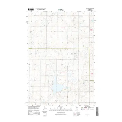
2016 Map of Watkins
USGS Topo · Published 2016About this map
The town of Watkins serves as the central hub of this agricultural and wetland landscape, situated directly on the boundary between Stearns Co and Meeker Co. The map documents a classic Midwestern rural grid of county roads and avenues, including Kramer RD and the border-defining Meeker Stearns St. To the south, the terrain is defined by a significant water system comprising Clear Lake and Little Mud Lake, while the north features the private airstrip Don's Landing Field and the meandering Clearwater River. This 2016 survey illustrates the modern intersection of aviation, regional transport via Co Hwy 21, and the persistent glacial lake geography that has dictated land use in this part of Minnesota for generations.
Find a feature on this map
67 named features on this map. Tap any name to fly to it.
Don’t see what you’re looking for? This feature index may not catch every label — zoom into the map to look around manually.
Map Details
Editions of this 2016 Watkins Map
This is the sole edition of this map. No revisions or reprints were ever made.
Other maps of this area

1953 · Saint Cloud
USGS Topo · 1:250,000

1957 · Saint Cloud
USGS Topo · 1:250,000

1958 · Saint Cloud
USGS Topo · 1:250,000

1958 · Dassel
USGS Topo · 1:62,500

1967 · Cold Spring
USGS Topo · 1:24,000

1967 · Litchfield North
USGS Topo · 1:24,000

1967 · Richmond
USGS Topo · 1:24,000

1967 · Watkins
USGS Topo · 1:24,000

1967 · Rockville
USGS Topo · 1:24,000

1967 · Kimball
USGS Topo · 1:24,000
Featured Places
- Watkins, MN
- Luxemburg Township, MN
- Maine Prairie Township, MN
- Watkins Mobile Home Park, Watkins
- Watkins Mobile Home Park, Watkins