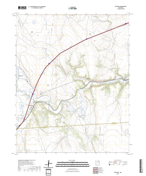
2023 Map of Watrous
USGS Topo · Published 2023About this map
The confluence of the Mora River and Sapello River anchors this landscape in northeastern New Mexico, where water management has historically defined local life. An intricate system of irrigation features, including the Tipton Ditch, Lower Phoenix Ditch, and North Company Ditch, reveals how generations have diverted these mountain-fed streams to support agriculture in a semi-arid environment. The historic path of the Santa Fe Trl cuts through the territory, running parallel to the modern interstate and the Rail Rd, illustrating the enduring importance of this corridor as a transportation artery.
Find a feature on this map
29 named features on this map. Tap any name to fly to it.
Don’t see what you’re looking for? This feature index may not catch every label — zoom into the map to look around manually.
Map Details
Editions of this 2023 Watrous Map
This is the sole edition of this map. No revisions or reprints were ever made.
Other maps of this area

1889 · Las Vegas
USGS Topo · 1:125,000

1891 · Las Vegas
USGS Topo · 1:125,000

1892 · Watrous
USGS Topo · 1:125,000

1893 · Las Vegas
USGS Topo · 1:125,000

1894 · Watrous
USGS Topo · 1:125,000

1954 · Santa Fe
USGS Topo · 1:250,000

1958 · Santa Fe
USGS Topo · 1:250,000

1963 · Fort Union
USGS Topo · 1:24,000
1963 · Loma Parda
USGS Topo · 1:24,000
1963 · Onava
USGS Topo · 1:24,000