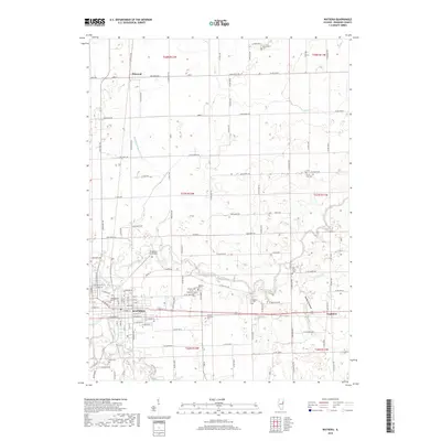
2018 Map of Watseka
USGS Topo · Published 2018About this map
The Iroquois River meanders through the heart of this Iroquois County landscape, defining the topography near the county seat at Watseka. This 2018 survey reveals a territory where traditional agriculture and riverine geography intersect with historical memory, evidenced by the high density of burial grounds. Significant sites for local history include the Grand Army of the Republic Cem and Oak Hill Cem, positioned just outside the main settlement. The rail corridor of TP&W RD 151 cuts through the region, connecting the smaller hamlets of Pittwood and Eastburn. Extensive drainage works like Middleport Ditch Number 1 demonstrate the long-term management of the prairie floor, while unique landmarks such as the Songwood Inn Airport and Iroquois Memorial Park provide modern points of interest amidst the older rural structure.
Find a feature on this map
124 named features on this map. Tap any name to fly to it.
Don’t see what you’re looking for? This feature index may not catch every label — zoom into the map to look around manually.
Map Details
Editions of this 2018 Watseka Map
This is the sole edition of this map. No revisions or reprints were ever made.
Other maps of this area

1935 · Watseka
USGS Topo · 1:48,000

1938 · Milford
USGS Topo · 1:48,000

1939 · Watseka
USGS Topo · 1:62,500

1939 · Cissna Park
USGS Topo · 1:62,500

1944 · Milford
USGS Topo · 1:62,500

1944 · Gilman
USGS Topo · 1:62,500

1946 · Gilman
USGS Topo · 1:62,500

1949 · Cissna Park
USGS Topo · 1:62,500

1953 · Danville
USGS Topo · 1:250,000

1955 · Danville
USGS Topo · 1:250,000