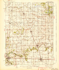
1939 Map of Watseka
USGS Topo · Published 1939About this map
The Iroquois River meanders across the eastern Illinois prairie, anchoring a landscape defined by organized drainage and a dense network of early 20th-century railroads. This 1930s survey captures Watseka as a bustling junction where the Chicago and Eastern Illinois meets the Toledo Peoria and Western. The surrounding townships, including Beaverville and Martinton, are carved into precise sections by an extensive system of artificial waterways like Main Ditch and Beaver Ditch, which were essential for converting the low-lying wet prairie into productive farmland.
Find a feature on this map
86 named features on this map. Tap any name to fly to it.
Don’t see what you’re looking for? This feature index may not catch every label — zoom into the map to look around manually.
Map Details
Editions of this 1939 Watseka Map
2 editions found
Other maps of this area

1922 · Momence
USGS Topo · 1:62,500

1922 · Kankakee
USGS Topo · 1:62,500

1924 · Momence
USGS Topo · 1:62,500

1924 · Kankakee
USGS Topo · 1:62,500

1935 · Watseka
USGS Topo · 1:48,000

1938 · Milford
USGS Topo · 1:48,000

1939 · Watseka
USGS Topo · 1:62,500

1939 · Cissna Park
USGS Topo · 1:62,500

1944 · Milford
USGS Topo · 1:62,500

1944 · Gilman
USGS Topo · 1:62,500