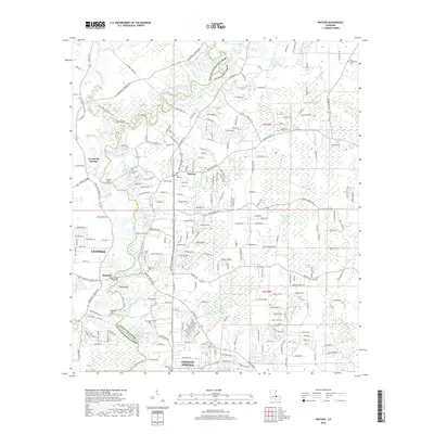
2018 Map of Watson
USGS Topo · Published 2018About this map
The Amite River carves a winding path through this corner of Louisiana, serving as the natural boundary between East Baton Rouge Parish and Livingston Parish. In the late 2010s, this landscape shows the intersection of suburban expansion and older rural foundations. To the west, the community of Central and the growing area of Greenwell Springs are defined by a dense network of residential roads like Alphonse Forbes Rd and Old Greenwell Springs Rd.
Find a feature on this map
218 named features on this map. Tap any name to fly to it.
Don’t see what you’re looking for? This feature index may not catch every label — zoom into the map to look around manually.
Map Details
Editions of this 2018 Watson Map
This is the sole edition of this map. No revisions or reprints were ever made.
Other maps of this area

1906 · Bayou Sara
USGS Topo · 1:125,000

1908 · Baton Rouge
USGS Topo · 1:62,500

1934 · Denham Springs
USGS Topo · 1:62,500

1939 · Zachary
USGS Topo · 1:62,500

1939 · Denham Springs
USGS Topo · 1:62,500

1939 · Baton Rouge
USGS Topo · 1:62,500

1942 · Pine Grove
USGS Topo · 1:31,680

1942 · Pride
USGS Topo · 1:31,680

1942 · Watson
USGS Topo · 1:31,680

1942 · Satsuma
USGS Topo · 1:31,680