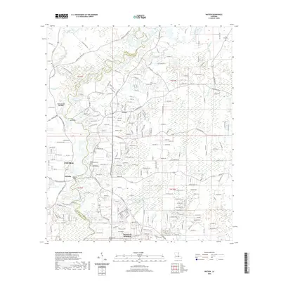
2020 Map of Watson
USGS Topo · Published 2020About this map
The Amite River meanders along the boundary between East Baton Rouge Parish and Livingston Parish, anchoring a landscape where established communities like Central and Watson have grown around historic river crossings. This modern survey documents the suburban and rural character of the region, where older landmarks such as Magnolia Bridge and the Country Bend Airport sit alongside a high concentration of local burial grounds. Genealogists will find significant detail in the mapping of both the Amite Baptist Church Cem Old and its newer counterpart, Amite Baptist Church Cem New, reflecting the deep-rooted community history of the area. The map also traces the drainage patterns of Sandy Creek and Spillers Cr as they feed into the Amite, illustrating the hydrological network that influenced the early settlement of places like Greenwell Springs and Magnolia.
Find a feature on this map
226 named features on this map. Tap any name to fly to it.
Don’t see what you’re looking for? This feature index may not catch every label — zoom into the map to look around manually.
Map Details
Editions of this 2020 Watson Map
This is the sole edition of this map. No revisions or reprints were ever made.
Other maps of this area

1906 · Bayou Sara
USGS Topo · 1:125,000

1908 · Baton Rouge
USGS Topo · 1:62,500

1934 · Denham Springs
USGS Topo · 1:62,500

1939 · Zachary
USGS Topo · 1:62,500

1939 · Denham Springs
USGS Topo · 1:62,500

1939 · Baton Rouge
USGS Topo · 1:62,500

1942 · Pine Grove
USGS Topo · 1:31,680

1942 · Pride
USGS Topo · 1:31,680

1942 · Watson
USGS Topo · 1:31,680

1942 · Satsuma
USGS Topo · 1:31,680