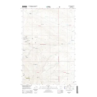
2014 Map of Watson
USGS Topo · Published 2014About this map
Watson and Preston anchor this high-country landscape within the Helena National Forest, where the complex drainage systems of the Big Belt Mountains define the local geography. The map reveals a dense network of gulches and hollows, many bearing names that hint at the region's historical prospecting and ranching heritage, such as Confederate Gulch, Democrat Gulch, and Kentucky Gulch. The northern portion is characterized by the winding paths of Cottonwood Cr and Beaver Cr, while the southern reaches show the boundary between Meagher and Broadwater counties. Transportation in this interior terrain relies on routes like Lingshire Rd and Benton Gulch Rd, which follow the natural contours of the land. Small water bodies like Stoyanoff Lake and numerous ephemeral streams like Thomas Cr illustrate the intricate hydrology of this mountain environment.
Find a feature on this map
45 named features on this map. Tap any name to fly to it.
Don’t see what you’re looking for? This feature index may not catch every label — zoom into the map to look around manually.
Map Details
Editions of this 2014 Watson Map
This is the sole edition of this map. No revisions or reprints were ever made.
Other maps of this area

1886 · Fort Logan
USGS Topo · 1:250,000

1948 · White Sulphur Springs
USGS Topo · 1:250,000

1958 · White Sulphur Springs
USGS Topo · 1:250,000

1961 · White Sulphur Springs
USGS Topo · 1:250,000

1965 · White Sulphur Springs
USGS Topo · 1:250,000

1966 · Boulder Baldy
USGS Topo · 1:24,000

1966 · Diamond City
USGS Topo · 1:24,000

1966 · Lingshire
USGS Topo · 1:24,000

1966 · Whites City
USGS Topo · 1:24,000

1966 · Watson
USGS Topo · 1:24,000