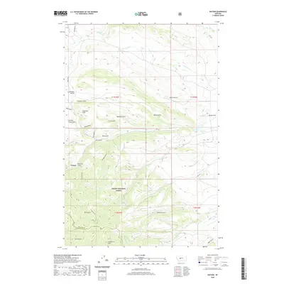
2020 Map of Watson
USGS Topo · Published 2020About this map
The settlement of Watson anchors this corner of the Big Belt Mountains, situated where Kentucky Gulch meets the drainage near the Meagher and Broadwater County line. The landscape is defined by an intricate network of steep ravines and seasonal watercourses, many bearing names that hint at the region's historical land use and early prospectors. Significant terrain features include Confederate Gulch, Ohio Gulch, and Democrat Gulch, which suggest a legacy of mining activity in the southern portion of the quadrangle within the Helena National Forest.
Find a feature on this map
37 named features on this map. Tap any name to fly to it.
Don’t see what you’re looking for? This feature index may not catch every label — zoom into the map to look around manually.
Map Details
Editions of this 2020 Watson Map
This is the sole edition of this map. No revisions or reprints were ever made.
Other maps of this area

1886 · Fort Logan
USGS Topo · 1:250,000

1948 · White Sulphur Springs
USGS Topo · 1:250,000

1958 · White Sulphur Springs
USGS Topo · 1:250,000

1961 · White Sulphur Springs
USGS Topo · 1:250,000

1965 · White Sulphur Springs
USGS Topo · 1:250,000

1966 · Boulder Baldy
USGS Topo · 1:24,000

1966 · Diamond City
USGS Topo · 1:24,000

1966 · Lingshire
USGS Topo · 1:24,000

1966 · Whites City
USGS Topo · 1:24,000

1966 · Watson
USGS Topo · 1:24,000