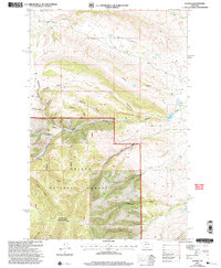
2001 Map of Watson
USGS Topo · Published 2004About this map
Helena National Forest terrain dominates this 2001 revision, where the Townsend Ranger District manages a landscape defined by an intricate network of drainages and named gulches. The settlement of Watson lies near the intersection of various water systems like Kentucky Gulch and Ohio Gulch, while Camp is situated further north among the folds of Batchelor Gulch. The mapping reflects a long history of land use, evidenced by features such as Lambing Camp Gl and Freighters Gulch, pointing toward early ranching and transportation routes through the mountains.
Find a feature on this map
36 named features on this map. Tap any name to fly to it.
Don’t see what you’re looking for? This feature index may not catch every label — zoom into the map to look around manually.
Map Details
Editions of this 2001 Watson Map
This is the sole edition of this map. No revisions or reprints were ever made.
Other maps of this area

1886 · Fort Logan
USGS Topo · 1:250,000

1948 · White Sulphur Springs
USGS Topo · 1:250,000

1958 · White Sulphur Springs
USGS Topo · 1:250,000

1961 · White Sulphur Springs
USGS Topo · 1:250,000

1965 · White Sulphur Springs
USGS Topo · 1:250,000

1966 · Boulder Baldy
USGS Topo · 1:24,000

1966 · Diamond City
USGS Topo · 1:24,000

1966 · Lingshire
USGS Topo · 1:24,000

1966 · Whites City
USGS Topo · 1:24,000

1966 · Watson
USGS Topo · 1:24,000