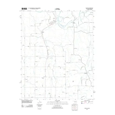
2012 Map of Watts
USGS Topo · Published 2012About this map
Illinois River crossings and family-named landmarks define this borderland region between Oklahoma and Arkansas. The settlement of Watts serves as a primary hub, situated near where Ballard Cr joins the larger river system. To the south, the community of Ballard and the remote outpost of Cincinnati anchor a landscape of ridges and valleys. The terrain is notably marked by prominent heights such as Mission Mtn, Bates Mtn, and Bell Mtn, which overlook a network of rural roads and creek beds including Peacheater Cr and Jaybird Cr. This 2012 survey illustrates the enduring rural character of the region, where historical river access points like Goforth Ford and Fishers Ford remain significant geographical markers alongside numerous local burial grounds including Sixkiller Cem and Brady Cem.
Find a feature on this map
77 named features on this map. Tap any name to fly to it.
Don’t see what you’re looking for? This feature index may not catch every label — zoom into the map to look around manually.
Map Details
Editions of this 2012 Watts Map
This is the sole edition of this map. No revisions or reprints were ever made.
Other maps of this area

1898 · Tahlequah
USGS Topo · 1:125,000

1898 · Winslow
USGS Topo · 1:125,000

1899 · Fayetteville
USGS Topo · 1:125,000

1899 · Siloam Springs
USGS Topo · 1:125,000

1901 · Winslow
USGS Topo · 1:125,000

1901 · Fayetteville
USGS Topo · 1:125,000

1901 · Tahlequah
USGS Topo · 1:125,000

1903 · Siloam Springs
USGS Topo · 1:125,000

1904 · Siloam Springs
USGS Topo · 1:125,000

1904 · Fayetteville
USGS Topo · 1:125,000