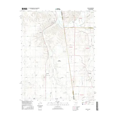
2016 Map of Watts
USGS Topo · Published 2016About this map
The Illinois River winds through the borderlands of Oklahoma and Arkansas, carving a valley where the settlements of Watts and Cincinnati serve as focal points for a rural landscape steeped in history. The terrain is marked by distinctive elevations such as Mission Mtn and Bates Mtn, which rise above the surrounding creek basins. A high concentration of burial sites suggests a long-established community structure, including the Baptist Mission Cemeter and the notable Reverend Jesse Bushyhead Grave. Local connectivity is defined by landmarks like the Goforth Bridge and the expanse of Lake Frances. In the southern reaches, the areas of Westville and Old Green appear alongside various family-named roads, while the network of waterways including Ballard Cr and Peacheater Cr highlights the natural drainage patterns that have shaped land use and property boundaries in this cross-border region.
Find a feature on this map
84 named features on this map. Tap any name to fly to it.
Don’t see what you’re looking for? This feature index may not catch every label — zoom into the map to look around manually.
Map Details
Editions of this 2016 Watts Map
This is the sole edition of this map. No revisions or reprints were ever made.
Other maps of this area

1898 · Tahlequah
USGS Topo · 1:125,000

1898 · Winslow
USGS Topo · 1:125,000

1899 · Fayetteville
USGS Topo · 1:125,000

1899 · Siloam Springs
USGS Topo · 1:125,000

1901 · Winslow
USGS Topo · 1:125,000

1901 · Fayetteville
USGS Topo · 1:125,000

1901 · Tahlequah
USGS Topo · 1:125,000

1903 · Siloam Springs
USGS Topo · 1:125,000

1904 · Siloam Springs
USGS Topo · 1:125,000

1904 · Fayetteville
USGS Topo · 1:125,000