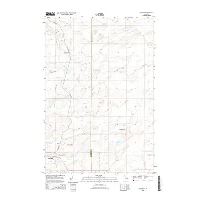
2014 Map of Waucedah
USGS Topo · Published 2014About this map
The settlement of Waucedah lies at the intersection of Us-2 and Foster City Rd in this modern topographic study of Dickinson and Menominee Counties. The landscape is defined by its complex hydrology, with the Sturgeon River and Little Cedar River carving through the terrain alongside numerous tributaries like Hamilton Cr and Beaver Cr. In the northern half of the quadrangle, the small community of Leapers is situated amidst a network of forest roads and glacial lakes, including Spruce Lake and the interestingly named Lake Number Eighteen. For those tracing local history, the Waucedah Township Cem serves as a primary genealogical landmark near the heart of the village. The mapping reflects a region where timber and transit remain central, as evidenced by the extensive naming of local routes such as Old CC Rd and Seven Hill Rd.
Find a feature on this map
37 named features on this map. Tap any name to fly to it.
Don’t see what you’re looking for? This feature index may not catch every label — zoom into the map to look around manually.
Map Details
Editions of this 2014 Waucedah Map
This is the sole edition of this map. No revisions or reprints were ever made.
Other maps of this area

1939 · Pembine
USGS Topo · 1:48,000

1947 · Pembine
USGS Topo · 1:48,000

1954 · Escanaba
USGS Topo · 1:250,000

1955 · Vulcan
USGS Topo · 1:24,000

1955 · Norway
USGS Topo · 1:62,500

1956 · Foster City
USGS Topo · 1:62,500

1957 · Escanaba
USGS Topo · 1:250,000

1958 · Escanaba
USGS Topo · 1:250,000

1963 · Pembine
USGS Topo · 1:62,500

1963 · Powers
USGS Topo · 1:62,500