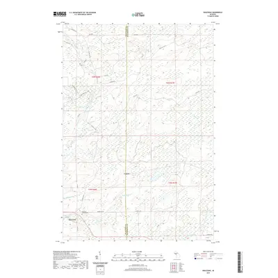
2019 Map of Waucedah
USGS Topo · Published 2019About this map
The settlement of Waucedah lies in the southwest corner of this landscape, positioned where the Hamilton Cr meets the local road network. This Dickinson County terrain is defined by a dense drainage system of creeks and rivers, including the winding Sturgeon River and Cassidy Cr. The area around Leapers is characterized by extensive wetlands and swampy lowlands, typical of the Upper Peninsula interior. Genealogists will find the Waucedah Township Cem clearly marked just north of the main settlement. Further east, the remote Lake Number Eighteen and the headwaters of the Little Cedar River highlight the wilder reaches of the quadrangle. Transportation is a mix of traditional routes like Foster City Rd and recreational paths such as Snowmobile Trail 115, reflecting the area's modern use for both local transit and outdoor access.
Find a feature on this map
40 named features on this map. Tap any name to fly to it.
Don’t see what you’re looking for? This feature index may not catch every label — zoom into the map to look around manually.
Map Details
Editions of this 2019 Waucedah Map
This is the sole edition of this map. No revisions or reprints were ever made.
Other maps of this area

1939 · Pembine
USGS Topo · 1:48,000

1947 · Pembine
USGS Topo · 1:48,000

1954 · Escanaba
USGS Topo · 1:250,000

1955 · Vulcan
USGS Topo · 1:24,000

1955 · Norway
USGS Topo · 1:62,500

1956 · Foster City
USGS Topo · 1:62,500

1957 · Escanaba
USGS Topo · 1:250,000

1958 · Escanaba
USGS Topo · 1:250,000

1963 · Pembine
USGS Topo · 1:62,500

1963 · Powers
USGS Topo · 1:62,500