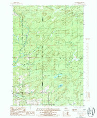
1986 Map of Waucedah
USGS Topo · Published 1986About this map
The Sturgeon River flows southward through the heart of this Upper Peninsula landscape, marking a corridor where the Copper Country State Forest meets the county line. The settlement of Waucedah anchors the southern portion of the sheet, situated near the junction of Cheney Creek and Hamilton Creek. The geography here is defined by a dense network of water, with smaller bodies like Spruce Lake, Leaper Lake, and Lake No 18 scattered among the timberlands of Meyer and Spalding townships.
Find a feature on this map
24 named features on this map. Tap any name to fly to it.
Don’t see what you’re looking for? This feature index may not catch every label — zoom into the map to look around manually.
Map Details
Editions of this 1986 Waucedah Map
This is the sole edition of this map. No revisions or reprints were ever made.
Other maps of this area

1939 · Pembine
USGS Topo · 1:48,000

1947 · Pembine
USGS Topo · 1:48,000

1954 · Escanaba
USGS Topo · 1:250,000

1955 · Vulcan
USGS Topo · 1:24,000

1955 · Norway
USGS Topo · 1:62,500

1956 · Foster City
USGS Topo · 1:62,500

1957 · Escanaba
USGS Topo · 1:250,000

1958 · Escanaba
USGS Topo · 1:250,000

1963 · Pembine
USGS Topo · 1:62,500

1963 · Powers
USGS Topo · 1:62,500
Featured Places
- Waucedah, Waucedah Township
- Spalding Township, MI
- Meyer Township, MI
- Waucedah Township, MI
- Leapers, Meyer Township