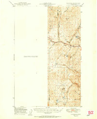
1951 Map of Wauconda
USGS Topo · Published 1951About this map
Colville National Forest and Chelan National Forest converge in this high-altitude landscape during the early post-war period. The terrain is defined by a dense network of drainages including Granite Creek, Sheridan Creek, and Tenmile Creek that carve through significant peaks like Storm King Mtn and Sheep Mtn. Mining activity is central to the local geography near the eastern edge, where the Knob Hill Mine, Tom Thumb Mine, and Flag Hill Mine are located, complete with noted Tailings piles. These industrial footprints contrast with the remote character of the southern lakes, such as Swan Lake, Ferry Lake, and Fish Lake. The presence of a Lookout on Sheep Mtn and the small settlement of Golden along Harvest Creek suggest a region shaped by both resource extraction and forest management, offering a clear record of the area's mid-century development and land use.
Find a feature on this map
30 named features on this map. Tap any name to fly to it.
Don’t see what you’re looking for? This feature index may not catch every label — zoom into the map to look around manually.
Map Details
Editions of this 1951 Wauconda Map
2 editions found
Other maps of this area

1902 · Osoyoos
USGS Topo · 1:125,000

1904 · Osoyoos
USGS Topo · 1:125,000

1904 · Republic
USGS Topo · 1:125,000

1948 · Curlew
USGS Topo · 1:62,500

1948 · Republic
USGS Topo · 1:62,500

1951 · Wauconda
USGS Topo · 1:62,500

1951 · Curlew
USGS Topo · 1:62,500

1951 · Bodie Mountain
USGS Topo · 1:62,500

1951 · Republic
USGS Topo · 1:62,500

1952 · Disautel
USGS Topo · 1:62,500