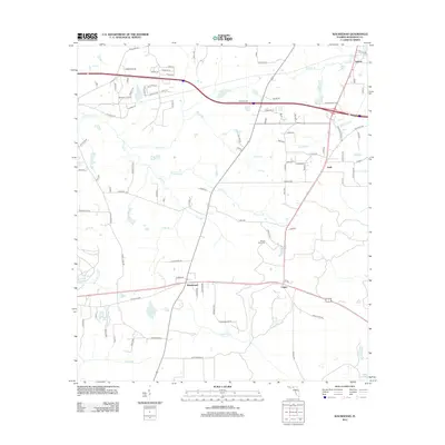
2012 Map of Waukeenah
USGS Topo · Published 2012About this map
The unincorporated community of Waukeenah sits at a historic crossroads in Jefferson County, where residential streets like Mallard Ln and Quail Ln meet the broader landscape of the Florida Panhandle. This inland territory is defined by a dense network of watercourses and small lakes, including the cypress-edged waters of Lake Catherine and Shadow Lake. To the east, Capps and the settlement of Nash appear along the regional transit corridors, while the Mount Olive Cem provides a point of genealogical interest north of the primary east-west highway. The land is drained by numerous small tributaries such as Morris Br and Coocksey Br, which move through a mosaic of timberland and clearings. Historically, the area's hydrology supported local industry, evidenced by features like Mill Pond Cr and Bailey Mill Cr, which suggest the former locations of water-powered milling operations.
Find a feature on this map
103 named features on this map. Tap any name to fly to it.
Don’t see what you’re looking for? This feature index may not catch every label — zoom into the map to look around manually.
Map Details
Editions of this 2012 Waukeenah Map
This is the sole edition of this map. No revisions or reprints were ever made.
Other maps of this area

1954 · Lloyd
USGS Topo · 1:24,000

1954 · Cody
USGS Topo · 1:24,000

1954 · Valdosta
USGS Topo · 1:250,000

1954 · Tallahassee
USGS Topo · 1:250,000

1955 · Lamont
USGS Topo · 1:24,000

1955 · Waukeenah
USGS Topo · 1:24,000

1955 · Lamont SE
USGS Topo · 1:24,000

1955 · Wacissa
USGS Topo · 1:24,000

1958 · Valdosta
USGS Topo · 1:250,000

1959 · Tallahassee
USGS Topo · 1:250,000