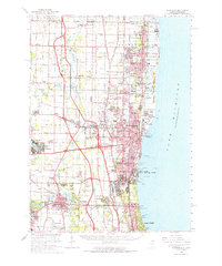
1960 Map of Waukegan
USGS Topo · Published 1962About this map
Lake Michigan dominates the eastern edge of this Lake County landscape, where the sprawling Great Lakes Naval Training Center and Camp Logan underscore a significant military presence along the shoreline. Further inland, the map captures a period of suburban transition as established centers like Waukegan, Zion, and Libertyville are connected by a dense web of rail lines, including the Chicago and North Western and the Chicago Milwaukee St Paul and Pacific.
Find a feature on this map
100 named features on this map. Tap any name to fly to it.
Don’t see what you’re looking for? This feature index may not catch every label — zoom into the map to look around manually.
Map Details
Editions of this 1960 Waukegan Map
This is the sole edition of this map. No revisions or reprints were ever made.
Other maps of this area

1892 · Racine
USGS Topo · 1:62,500

1893 · Silver Lake
USGS Topo · 1:62,500

1899 · Evanston
USGS Topo · 1:62,500

1900 · Highwood
USGS Topo · 1:62,500

1905 · Racine
USGS Topo · 1:62,500

1906 · Silver Lake
USGS Topo · 1:62,500

1906 · Waukegan
USGS Topo · 1:62,500

1908 · Waukegan
USGS Topo · 1:62,500

1920 · Grays Lake
USGS Topo · 1:62,500

1923 · Grays Lake
USGS Topo · 1:62,500