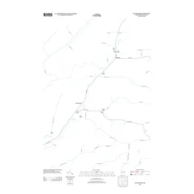
2013 Map of Waumandee
USGS Topo · Published 2013About this map
Waumandee and Montana serve as the primary focal points of this Buffalo County survey, situated within a landscape defined by an intricate network of narrow valleys and ridges. The geography is characterized by numerous family-named landmarks such as Hunt Valley, Danuser Valley, and Knecht Valley, suggesting a history of multi-generational land tenure. The drainage pattern is anchored by Waumandee Cr and its tributary, Little Waumandee Cr, which dictate the placement of roads like County Hwy-E and County Hwy-U. Higher elevations are marked by distinct features such as Rotering Ridge Rd and Canada Ridge Rd, while more isolated routes like Pansy Pass and Jesses Trl navigate the steeper terrain. This map provides a detailed view of the rural infrastructure and valley-bottom settlements that have shaped this portion of western Wisconsin.
Find a feature on this map
40 named features on this map. Tap any name to fly to it.
Don’t see what you’re looking for? This feature index may not catch every label — zoom into the map to look around manually.
Map Details
Editions of this 2013 Waumandee Map
This is the sole edition of this map. No revisions or reprints were ever made.
Other maps of this area

1929 · Fountain City
USGS Topo · 1:62,500

1932 · Cochrane
USGS Topo · 1:62,500

1932 · Gilmanton
USGS Topo · 1:62,500

1932 · Alma
USGS Topo · 1:62,500

1934 · Winona
USGS Topo · 1:62,500

1934 · Cochrane
USGS Topo · 1:62,500

1937 · Winona
USGS Topo · 1:62,500

1937 · Cochrane
USGS Topo · 1:62,500

1950 · Alma
USGS Topo · 1:62,500

1953 · Eau Claire
USGS Topo · 1:250,000