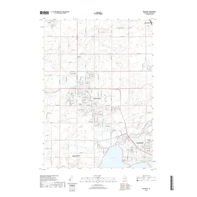
2018 Map of Waunakee
USGS Topo · Published 2018About this map
Waunakee sits at the center of this landscape, surrounded by a complex network of wetlands and small aviation hubs. The drainage of Sixmile Creek and Dorn Creek shapes the geography south of the village, eventually feeding into the northern reaches of Lake Mendota at Farwells Point. This modern survey reveals a highly developed residential and agricultural corridor between Dane and the northern outskirts of Madison, showing how the suburban footprint has expanded near the Yahara River. Genealogists will find several significant burial sites, including Union Cem of Vienna and the historic Saint John's Cem within the village. Local aviation is represented by both Dane Airport and Waunakee Airport, while the sprawling Waunakee Marsh dominates the western edge of the village.
Find a feature on this map
160 named features on this map. Tap any name to fly to it.
Don’t see what you’re looking for? This feature index may not catch every label — zoom into the map to look around manually.
Map Details
Editions of this 2018 Waunakee Map
This is the sole edition of this map. No revisions or reprints were ever made.
Other maps of this area

1890 · Madison
USGS Topo · 1:62,500

1892 · Madison
USGS Topo · 1:62,500

1895 · Baraboo
USGS Topo · 1:62,500

1901 · Poynette
USGS Topo · 1:62,500

1904 · Madison
USGS Topo · 1:62,500

1906 · Madison
USGS Topo · 1:62,500

1907 · Cross Plains
USGS Topo · 1:62,500

1908 · Baraboo
USGS Topo · 1:62,500

1909 · Cross Plains
USGS Topo · 1:62,500

1957 · Madison
USGS Topo · 1:250,000