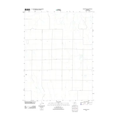
2011 Map of Wauneta SE
USGS Topo · Published 2011About this map
Donze Airport sits as a primary landmark in this section of Chase County, Nebraska, where the high plains landscape is defined by a rigid grid of section roads and drainage coulees. This 2011 survey illustrates the rural infrastructure of the southwest corner of the state, centered on the intersection of Neighborhood Rd and east-west thoroughfares like 6th Ave and 8th Ave. The map details the precise boundaries along Co Line Rd, where the agricultural layout meets the county divide. While the terrain is dominated by natural watercourses, the human imprint is clear through the systematic naming of rural routes such as Road 724, Road 722, and Road 720. This document provides researchers and surveyors an exact record of the transportation network and land divisions in this Nebraska farming region during the early twenty-first century.
Find a feature on this map
11 named features on this map. Tap any name to fly to it.
Don’t see what you’re looking for? This feature index may not catch every label — zoom into the map to look around manually.
Map Details
Editions of this 2011 Wauneta SE Map
This is the sole edition of this map. No revisions or reprints were ever made.
Other maps of this area

1954 · McCook
USGS Topo · 1:250,000

1957 · McCook
USGS Topo · 1:250,000

1958 · McCook
USGS Topo · 1:250,000

1962 · Stratton
USGS Topo · 1:24,000

1962 · Max NE
USGS Topo · 1:24,000

1973 · Wauneta SW
USGS Topo · 1:24,000
1973 · Rock Canyon
USGS Topo · 1:24,000

1973 · Palisade SW
USGS Topo · 1:24,000

1973 · Wauneta SE
USGS Topo · 1:24,000

1974 · Hamlet
USGS Topo · 1:24,000